Atlanta Case Study Investigation
Students will investigate the formation of urban heat islands. Atlanta, Georgia will be used as a case study. Students will use satellite images of downtown Atlanta and its suburbs to examine temperature patterns of these areas.
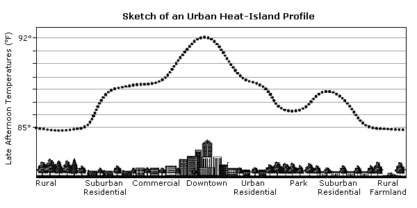
- Display the sketch of an urban heat-island profile to the front of the class. Ask students what causes the formation of urban heat islands. Emphasize that materials used to develop roads and buildings such as asphalt absorb more heat compared to trees and grasses.
- Instruct students to open the Downtown Atlanta.kml file in Google Earth. Display the image in front of the classroom. Tell students this is the downtown area of Atlanta, Georgia and is considered a densely populated urban city center. Ask students to describe the land cover features in the aerial image. Prompt students with the following questions:
a) Do you observe more building and roads or more forested or farmland area? (Buildings and roads)
b) If you walked on the streets in the downtown area on a summer day, what would the temperature feel like? (Hot).
c) Why? (Heat is being absorbed from the sun and reradiated).
d) Where might you find "cool areas" in downtown Atlanta? (Shadows of buildings, under trees).
Notes:
- Prompt students to identify and discuss examples of tone, size, texture, pattern, shadow, site, and association in the aerial image.
- Highlight specific examples as needed to illustrate each element.
- Instruct students to open the Suburban Atlanta.kml file in Google Earth. Display the image in front of the classroom. Tell students this is aerial image includes part of Atlanta, Georgia and its suburbs. Ask students to describe the land cover features in the aerial image. Prompt students to identify and discuss examples of tone, size, texture, pattern, shadow, site, and association in the aerial image. Highlight specific examples as needed to illustrate each element.
- Distribute the handout, Atlanta Case Study to each student. Instruct students to read top paragraphs. Display the "Downtown Atlanta Day Temperature" and "Atlanta Suburban Day Temperature" thermal images to the front of the classroom (from Thermal Data Images: Atlanta Case Study Web site). Have students complete the questions #1-4. Discuss answers after students have had time to complete these questions.
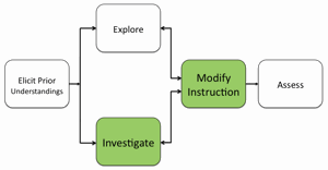
- If students at the completion of this class session still have difficulty interpreting the data displayed in the thermal images, modify instruction to ensure students understand how to use these spatial analysis skills.
- Display the "Downtown Atlanta Day Temperature" and "Downtown Atlanta Night Temperature" thermal images to the front of the classroom (from Thermal Data Images: Atlanta Case Study). Have students complete questions #5-7. Discuss answers after students have had time to complete these questions.
Materials Needed:
Sketch of an urban heat-island profile image
Atlanta Case Study: Investigation Sheet (PDF / MS Word)
Thermal Data Images: Atlanta Case Study Web site or handout (PDF / MS Word)
Google Earth files:
Assessment Information:
Atlanta Case Study Assessment (PDF / MS Word)
Supplemental Homework Readings for Students
Here Comes Urban Heat (PDF)
Teacher Resources