Exploring Wind Farms with Google Earth

1. Begin the class by asking students to respond to the following in their journal: Describe a wind farm.
2. Inform students that they will use Google Earth to explore wind farms around the world.
3. Distribute the Exploring Wind Farms with Google Earth handout and field guide to each student.
4. Use an LCD projector to display Google Earth at the front of the room.
5. Ask students to launch Google Earth on their computers.
6. Instruct students to download the Wind Farms KML file and view the file in Google Earth.
7. Show students how to navigate from one wind farm to the next.
8. At the first wind farm location, zoom-in a bit to show students individual wind turbines.
Implementation suggestion:
- At the Taff Ely location, show students the dark shadows that are cast from the wind turbines. Inform students that it is helpful to look for these shadows to help identify the locations of the wind turbines.
9. Model how to use the Ruler Tool in Google Earth to measure the estimated perimeter of the first wind farm (Taff Ely). Have students repeat this task on their computers.
NOTE: We recommend that you explain to students how they should measure the perimeter of a wind farm. For example, have students identify four imaginary corners that form a “box” around the wind turbines and measure around that box. Alternatively, you may wish students to measure the perimeter by following closely along the turbines. The assessment information takes into account these variations. Tell students that they can identify wind turbines by the shadows they cast on the ground. If students zoom-in and have difficulty viewing the entire wind farm, remind them that they can double-click on the wind farm name or yellow pushpin to return to the initial display.
10. Instruct students visit each wind farm one at a time to complete the entire Wind Farms Data Chart. For example, students should first visit the Taff Ely wind farm and complete the first row of the data chart before moving on to the next wind farm.
Important note: You may note in some locations that wind turbines are currently being constructed. If students notice this, you may wish to tell them not to include those turbines in the perimeter measurement of that particular wind farm.
11. Provide guidance to students as needed. Instruct students to answer the questions on their field guides.
12. Review and discuss aloud student responses to key questions. Ask students if they have any questions about concepts covered in the lesson and respond to their questions. Have students close and not save Google Earth when they finish.
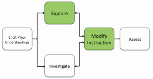
13. If students at the completion of the activity do not understand that ideal locations for wind farms include areas with good sustained wind speed and land areas that include open, flat areas or hilly areas, modify instruction to ensure students understand this concept.
Materials Needed:
Handouts
(1) Exploring Wind Farms with Google Earth Teacher Guide (PDF / MS Word)
(2) Exploring Wind Farms with Google Earth Student Handout (PDF / MS Word)
(3) Exploring Wind Farms with Google Earth Field Guide (PDF / MS Word)
KML File
Wind Farms (KML)
Assessment Information
Exploring Wind Farms with Google Earth Assessment (PDF / MS Word)
Teacher Resources/Content Support
