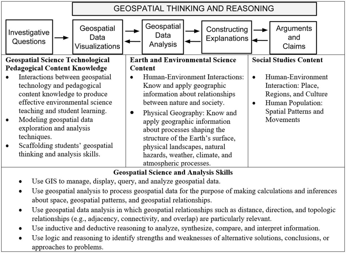
Instructional Framework
Our geospatial curriculum approach for learning builds on our previous design work and the National Science Foundation’s (NSF) Geotech Center’s Geospatial Technology Competency Model (Bodzin, 2011; Bodzin et al., 2012; Kulo & Bodzin, 2013; Bodzin, Fu, Bressler, & Vallera, 2015).
The curriculum approach incorporates design principles in each investigation to promote geospatial thinking and reasoning skills. These principles include:
- Use motivating contexts and personally relevant and meaningful examples to engage learners.
- Design image representations that illustrate visual aspects of social studies and Earth and environmental scientific knowledge.
- Design Web GIS data to make geospatial relations readily apparent.
- Scaffold students to analyze geospatial relations (Jonassen, 1999; Quitana et al., 2004).
- Develop curriculum materials that better accommodate the learning needs of all students, while also expanding the geospatial pedagogical content knowledge (PCK) of teachers.
A primary goal of this curriculum approach is to develop geospatial learning activities in such a way that the software and hardware become transparent to the user. The initial geospatial data visualizations for our investigations are designed to be quick and intuitive for both students and teachers to use, thus decreasing interface issues that were reported by users of other GIS platforms. The learning activities include teacher support materials that use Web-based videos, text, and graphics to promote and support teachers’ learning of important socio-environmental science subject matter and specialized geospatial PCK that they typically lack. Each learning activity is designed to include baseline instructional guidance for teachers and provide implementation and adaptation guidance for teaching a variety of learners, including reluctant readers, English language learners and students with disabilities.