In this investigation, students will locate oceanic and continental transform boundaries and study their history. They will:
- Investigate an oceanic transform boundary, the Charlie-Gibbs Fracture zone, using earthquake and age of the ocean floor data.
- Investigate a continental transform boundary, the San Andreas Fault zone, and the seismic hazards associated with living in this area using earthquake data and historical photographs.

- Prior to implementing this learning activity, make sure that students have some prerequisite knowledge about transform boundaries (strike-slip fault) and sea floor spreading. It is helpful if students have some knowledge about the type of destruction that can result from earthquakes. These concepts are explored in more detail in this investigation.
- We recommend that you read the What happens when plate move sideways past each other? Teacher Guide prior to implementing this investigation. The Teacher Guide contains additional content and pedagogical support materials that are not described on this Web page.
Note: A video overview of the learning activity is located below in the Teacher Resources/Content Support section of this Web page. This overview shows how to use the GIS for data analysis in the investigation. A second video provides an overview of the Web GIS interface and navigation features. You may wish to show your students these videos as you introduce the learning activity.
Suggested Sequence:
2. Inform students that they will use a GIS to learn about transform plate boundaries using earthquake data and historical imagery.
3. Use an LCD projector to display the Web GIS to the front of the room. The Web GIS will open to a global view with the Plate Boundary layer turned on displaying two blue investigation boxes on the GIS: the Charlie-Gibbs Fracture zone and the San Andreas Fault zone.
4. Distribute the What happens when plate move sideways past each other? Student Guide and Investigation Sheet to each student. Instruct students to follow the directions outlined in their guides.
5. Instruct students to go to: /learners/tectonics/ and click on What happens when plate move sideways past each other?
6. If needed, provide an orientation of the Web GIS layout and tool features to your students. We recommend that you show students how to use the Map Layers tab to activate and deactivate layers and how to use the Map Legend tab to interpret the data layers.
7. Model how to use the Navigation Tools tab to zoom the map into the first study area, the Charlie Gibbs Fracture zone.
8. Have students begin the investigation, complete all data charts and answer the questions on their investigation sheets. Provide guidance to students as needed.
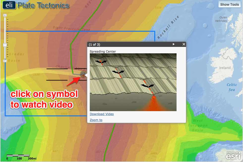
9. When students reach Step 3, watch the video with your students. Show your students that in between the divergent boundaries the plates slide past one another (see image below), along the transform boundaries. Next, highlight how the crust moves in opposite directions at the transform boundary. To the left and the right of the transform boundary, you can see that the crust is “fractured”.

Implementation suggestions:
- In Step 3, if students have difficulty identifying areas to draw fracture zones, show them how to zoom-in closely in the GIS viewer to identify the offsets in the age of the ocean floor that identify fracture zones.
- For classes with students with special needs, you may wish to provide additional modeling, prompts and guidance as students work through the investigation. You may wish to explicitly model each procedural step with the Web GIS using a projected image before the students work independently or in pairs to complete the learning tasks.
10. Review and discuss aloud student responses to key questions on their Investigation Sheets. Ask students if they have any questions about concepts covered in the lesson and respond to their questions.
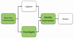
11. If students at the completion of the activity do not understand that plates slide past each other at transform boundaries, and such boundaries can occur on continents and in oceans and can pose major seismic threat to humans, modify instruction as needed to ensure students understand these concepts.
12. To provide closure to this investigation, have students reflect on what they have learned about transform boundaries and discuss their responses. Here are some suggestions:
Provide students with a reflective question to respond in their journals about tectonics. For example:
a) How safe is it to live near a transform plate boundary?
b) Why are there no volcanoes located along transform boundaries?
Materials Needed:
Handouts
(1) What happens when plate move sideways past each other? Teacher Guide (PDF / MS Word)
(2) What happens when plate move sideways past each other? Student Guide (PDF / MS Word)
(3) What happens when plate move sideways past each other? Investigation Sheet (PDF / MS Word)
Web GIS
http://gisweb.cc.lehigh.edu/tectonics/investigation5/
Assessment Information
What happens when plate move sideways past each other? Assessment (PDF / MS Word)
PowerPoint File
Examples of Fault Types (PPT)
Teacher Resources/Content Support
Geologic Faults - Print Version (PDF)
Web GIS Investigation 5 Tutorial (QuickTime Video)
Web GIS Features Overview (QuickTime Video)
